Land Planning Geographical Information System by R-Systems - LPGIS -
With LPGIS, hard copy maps and special software for reading different digital formats are no longer necessary.
WORK PRINCIPLE
A structured system of spatial objects with different shapes and presentation rules covers all the elements used in land planning.In the Data Dictionary land planning elements and relationships between them are defined. Users can browse it both by object names and attributes.
In the Presentation Library presentation of each planning element is described in detail.
The GIS database, accessible by Web application, binds the Data Dictionary and the Presentation Library.
Users enter the Web application URL in compliance with their rights, which allows either only observing the Land Plans or changing them as well. User rights can be set according to the location or in compliance with other rules.
No downloading is required as all the functionality and data are located on the server.  
FUNCTIONS
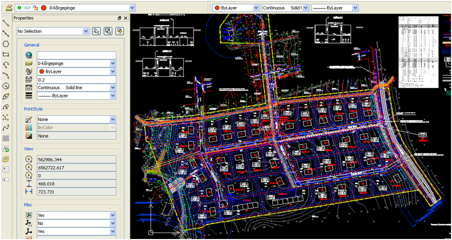
Land plans, drawn by means of licensed software, can be imported into the system from the following formats:- Autocad – DWG
- Microstation – DGN
- Mapinfo – TAB
MAPS
LPGIS spatial data can be presented on Google Maps. However, if the User has some better base map data, R-Systems can create a WMS server on for it.SAMPLES
(click the thumb to open screenshot in full size)1) Land plan in DWG format
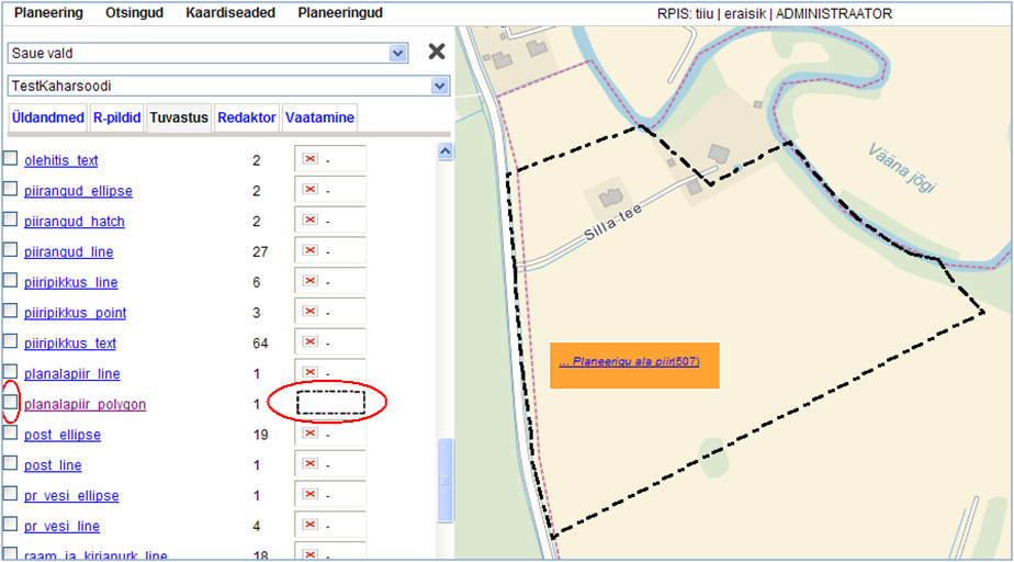
2) Plan elements recognized automatically in GIS
3) Manual recognition
4) Attaching building rights
5) Editing detailed data of an object
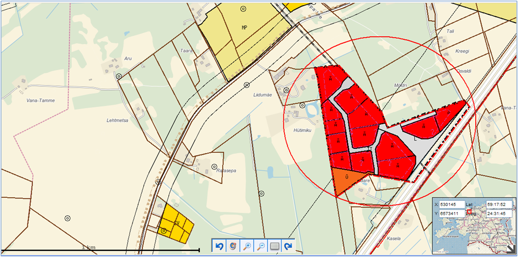
6) Comparing Detail Land Plan with the General Plan
1) Land plan in DWG format |
|
2) Plan elements recognized automatically in GIS |
|

3) Manual recognition:- first a shape from converted CAD file is chosen: |
|
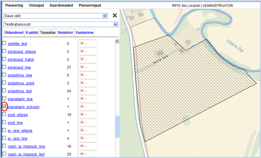
| - then presntation must be attatched from presentation list: |
|
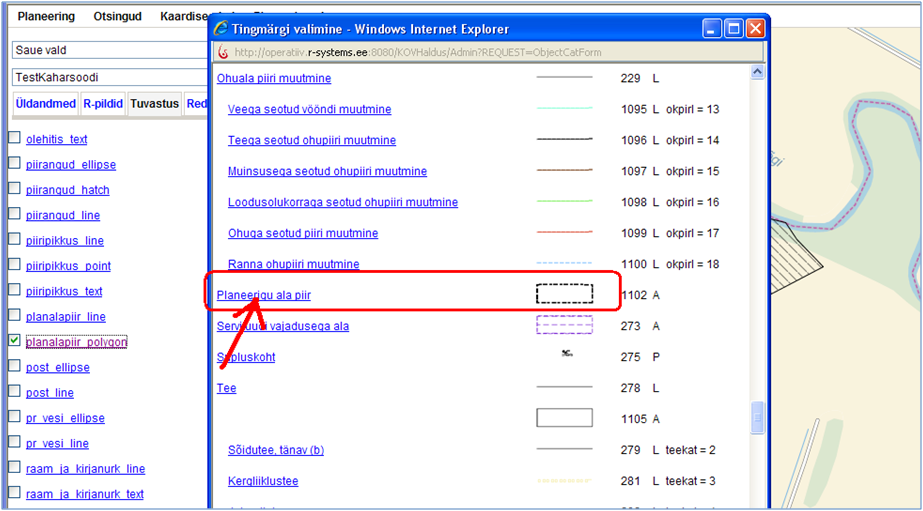
| - as a result, shape is recognized as the plan border: |
|
4) Attaching building rights |
|
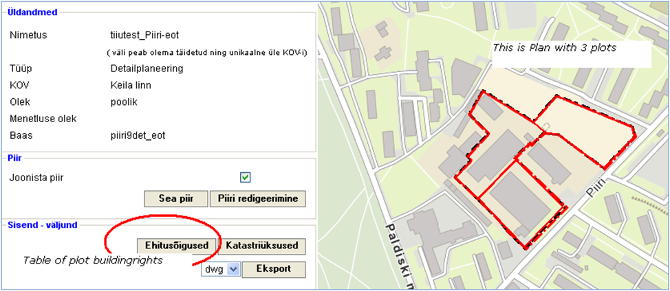
| - Plot building rights table |
|
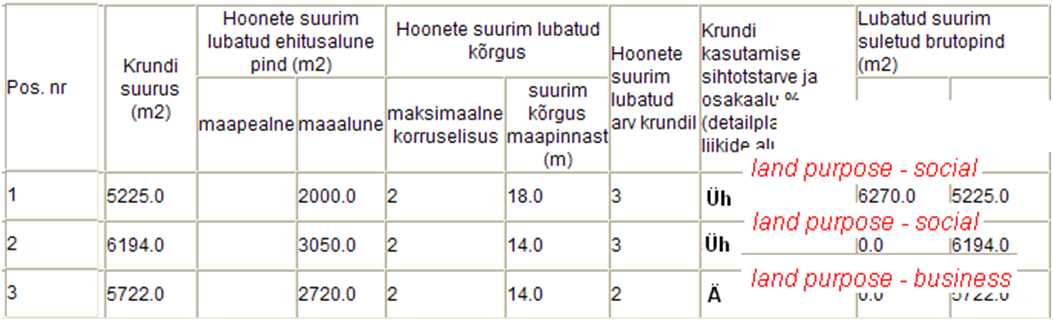
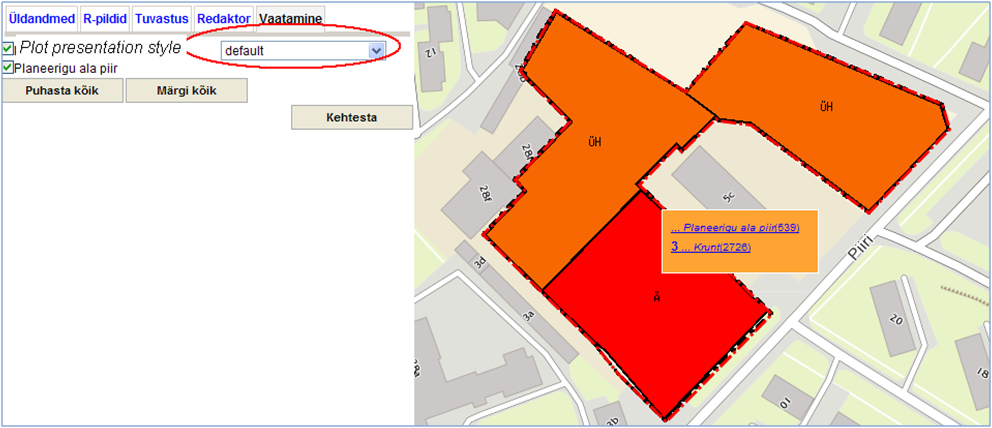
| - After inserting plot building rights, the plots obtain different presentations: |
|
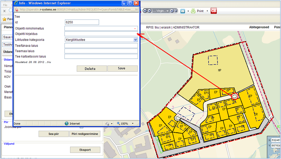
5) Editing detailed data of an object |
|
6) Comparing Detail Land Plan with the General Plan |
|